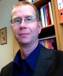
Ross joined BU in 2007 having spent 10 years at the Natural Environment Research Council’s (NERC) Centre for Ecology and Hydrology (CEH) in the Earth Observation team. Before CEH, he completed a PhD at the University of Wales, Swansea. He also has a 1st class BA (Hons) in Geography from the University of Oxford. Ross is a fellow of the Remote Sensing and Photogrammetry Society (RSPSoc) and a Senior Fellow of the Higher Education Academy (HEA).
Ross’ research focuses on applying remote sensed data to model forest structure and species composition, so he can identify the factors determining habitat quality and measure how they change over time. "I am currently investigating forest dynamics in the Peruvian Amazon where using technology like laser scanners, I can understand and explain how birds and mammals are using the forest as their habitat. This is important in a changing world," Ross explains.
Ross delivers teaching on geoinformatics within the Department of Life & Environmental Sciences (including geo-spatial science, the use of GIS, and environmental remote sensing). Ross was the Associate Dean Education for the former School of Applied Sciences during 2011-13, being responsible for overseeing the management of all under-graduate and post-graduate taught provision within the School. He led on the development and delivery of a Student Experience Strategy, with a focus on providing a clear structure and innovative approach to improving the student experience, and ensured that the delivery of all teaching across the School maintained subject benchmarks and recognised quality standards.
Ross loves the outdoors, so when he gets time to relax, outdoor pursuits are top of the list including hiking, running, cycling, kayaking and scuba diving. Best of all, "I love being up in the mountains at high altitude. Mountains are very tough and unforgiving places to be, but they are also beautiful and often pristine environments"
Research
My research interests are in environmental applications of remote sensing. I work with satellite and airborne remotely sensed data (hyper-spectral and LiDAR), investigating their integration and their incorporation with diverse field datasets. This enables me to investigate habitats and ecological relationships; working at different spatial scales from local to national focus. I have studied agricultural, upland and inter-tidal ecosystems, but my main interest is in forests; particularly temperate deciduous forest and tropical rain forest. I am interested in quantifying organism-habitat relationships and developing indicators of biodiversity from remotely sensed and environmental data. My focus is in using remote sensed data to model forest structure, species composition, and turnover (i.e. regeneration, disturbance), in order to assess woodland condition, identify the factors determining habitat quality (especially for woodland birds and mammals) and evaluate how they change over time.
Current projects include:
Assessment of forest structure and disturbance history on primate population density and habitat use in Sumatran rain forest.
Landscape-scale assessment of woodland bird habitat: predicting the consequences of landscape and environmental change on population sizes and biodiversity.
Assessment of gap-size frequency across Amazonia: contextualising the RAINFOR network of permanent sample plots using remote sensing data
For details on my research and getting involved in see: http://go-leap.wix.com/home. We offer MRes course (Masters by Research) in Primatology and biodiversity conservation as part of LEAP. Placement and project opportunities are also available. See: http://go-leap.wix.com/home#!get-involved/eqrp6
Please contact me if you are interested.
Publications
Journal articles
Books
Chapters
Conferences
Grants
Grants
Outreach & engagement
External responsibilities
Public engagement & outreach activities
This page is a shortened version of a BU academic profile. To view the complete profile, visit our Staff Profiles site.
